

Atlasly for Rhino: the AI agent that does the work
Tell Rhino what you want. Build site context, compare massing options, check sunlight and prepare planning drawings—with measured geometry and one Undo per request.
Quick answer
Atlasly for Rhino is an AI assistant that works directly on your Rhino geometry. Describe a task to import site context, build and compare massing options, run indicative daylight checks or create scaled drawings. It uses Rhino to measure results and groups each request into one Undo. Early access is opening for Rhino 8 on macOS and Windows.
A site model to build. Eight options to compare. A section to cut before the meeting. Most of the work between an architectural idea and a useful drawing is still a sequence of small, careful operations.
Atlasly for Rhino lets you describe the outcome instead. Select your buildings and say, “make these 21 m tall except these two.” Ask for the surroundings of an address. Request a location plan at 1:1250 with the red line. Atlasly works on the geometry in Rhino, checks the result and tells you what happened.
Rhino 8.21+ · macOS and Windows · 150+ operations
Join the Rhino early-access waitlist
The capabilities below describe version 0.4.0-alpha.5, based on Atlasly’s product brief and internal test reports dated 26 September 2026. Performance figures are benchmark observations, not a promise for every project.
Inside Rhino · NOMA, Manchester
From a plot to a proposal
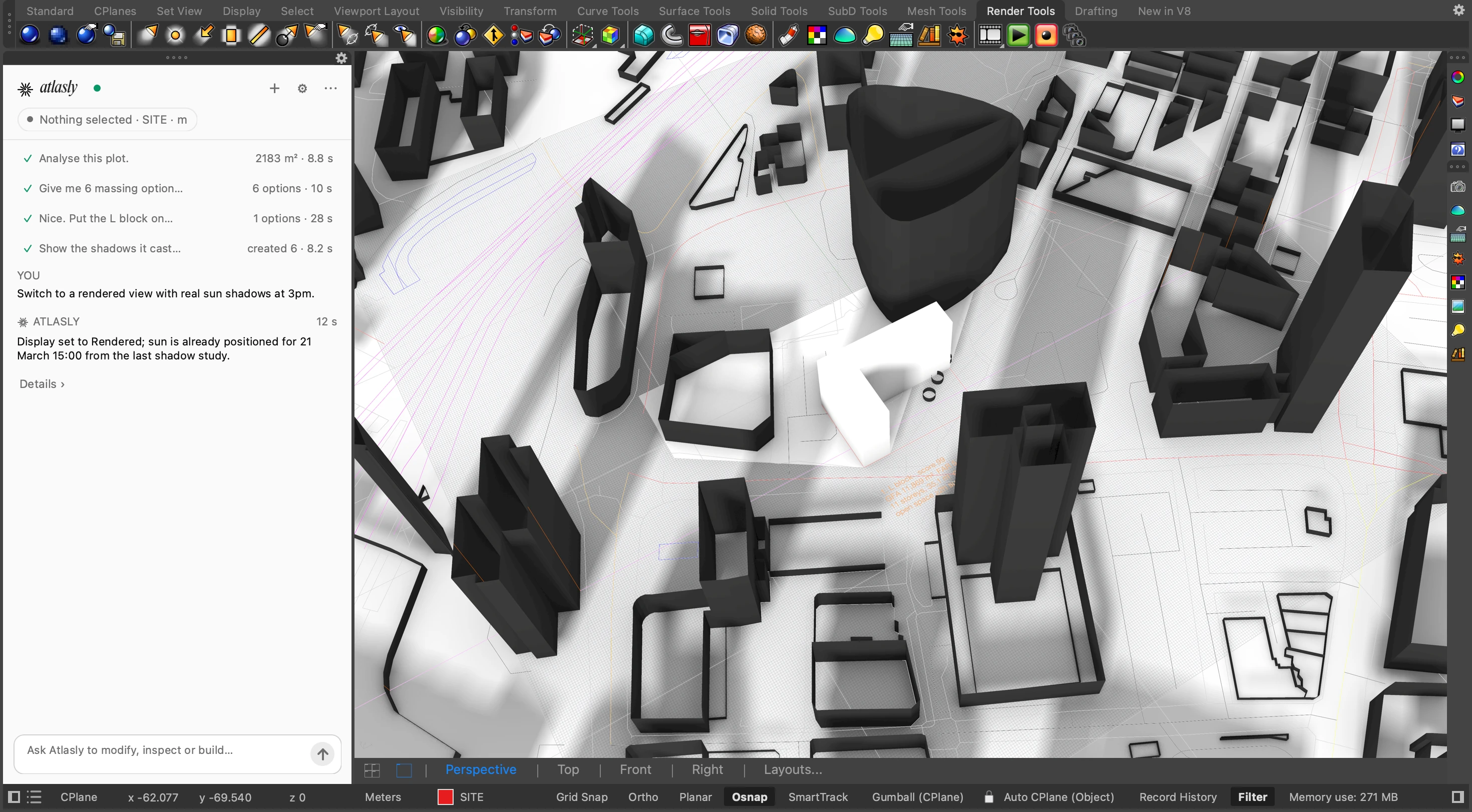
What can Atlasly do inside Rhino?
Atlasly supports early design work across RIBA Stages 0–3: site context, feasibility, massing, option comparisons, early environmental checks and drawings for planning readiness.
| Start with | Ask for | Review in Rhino |
|---|---|---|
| An address | “Import the site around NOMA, Manchester, 250 m around it” | Buildings, roads, water, parks and terrain |
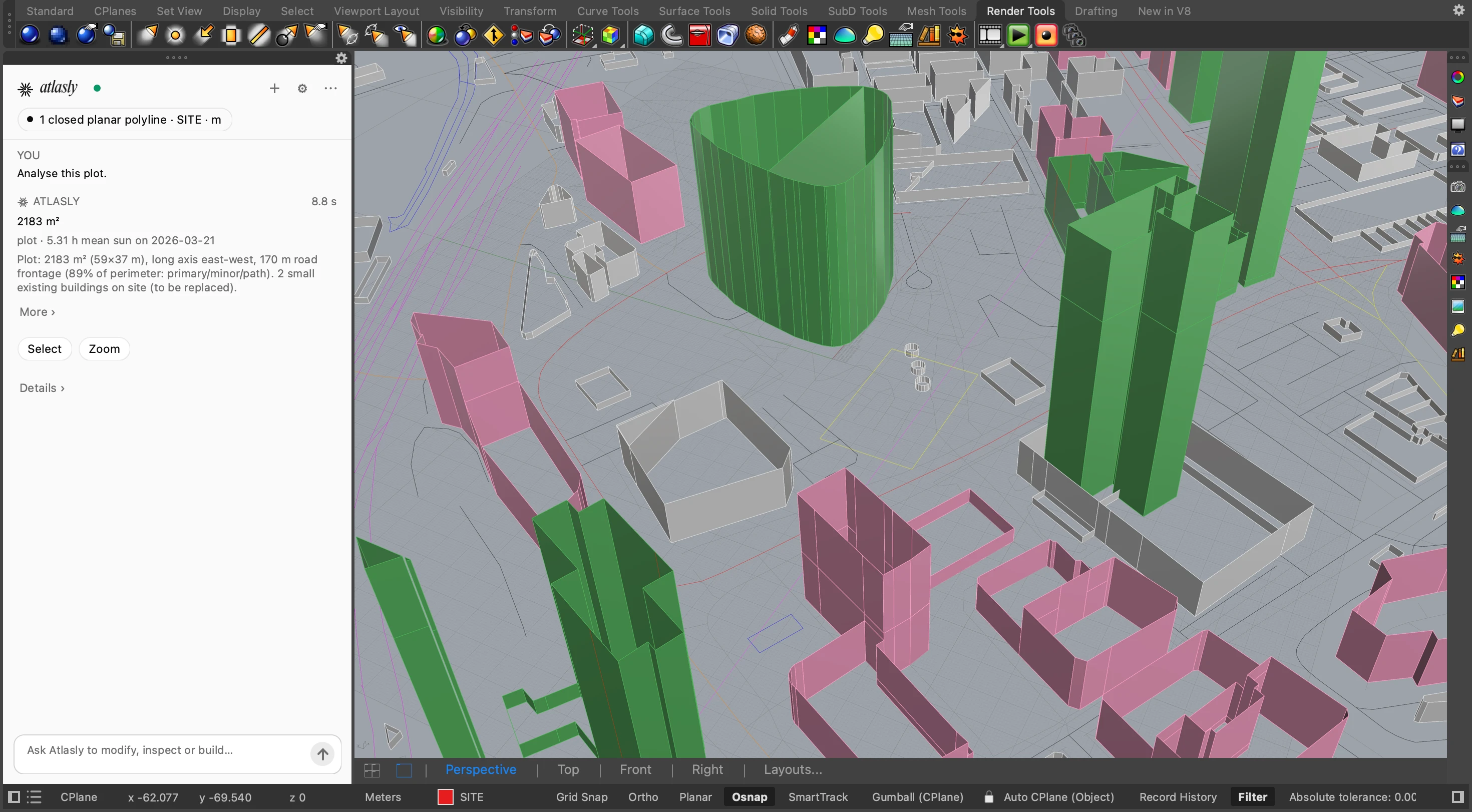
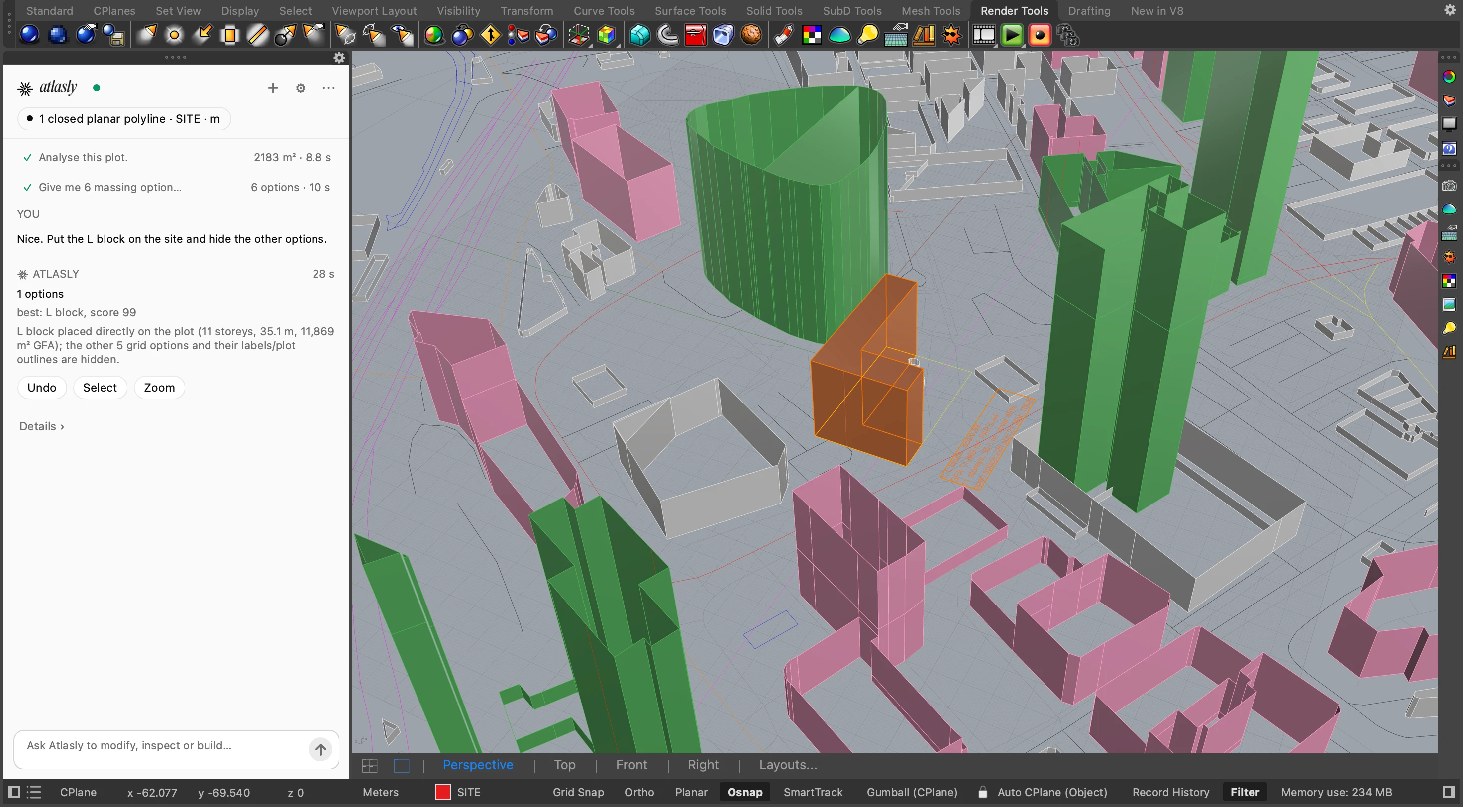
| A drawn plot | “Give me 8 massing options for 12,000 m² of residential, max 40 m” | Labelled options scored against the brief |
| Selected blocks | “GIA per floor and total, assume 300 mm external walls” | Measured areas with the assumptions stated |
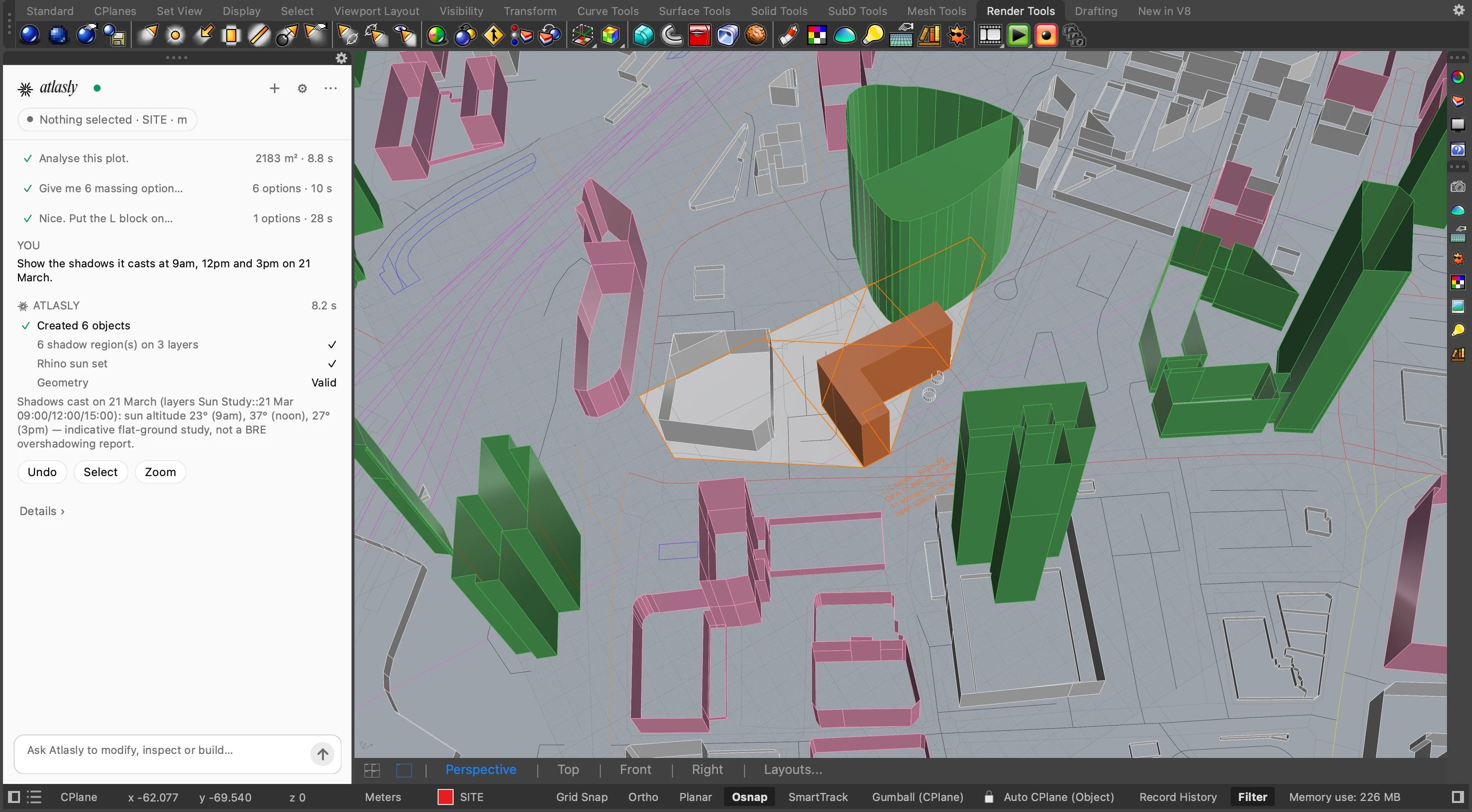
| A proposal | “Show shadows at 9, 12 and 3 on 21 March” | Shadow shapes for an indicative early check |
| A working model | “Location plan at 1:1250 with red line” | A scaled sheet to review before export |
The result is editable geometry and drawings in your working file. You can continue designing with Rhino’s usual tools.
From an address to site context in seconds
Start with a place, rather than an empty viewport. Atlasly imports surrounding buildings as solids, roads by type, rail, water, parks and terrain, positioned for sun studies. The internal NOMA, Manchester benchmark imported a 500 m square in about 3.5 seconds.
Every building records where its height came from: a tagged height, a storey count or an estimate. That distinction matters when deciding which neighbours need better survey information.
Already have OS or CAD data? Atlasly can resolve metre/millimetre mismatches, move far-away British National Grid coordinates to the origin while recording the offset, extrude footprints using OS Building Height Attribute values, place buildings on terrain and separate CADMapper’s merged building mesh.
Try: “Extrude the buildings using the BHA heights”, then “Put the buildings on the ground.” Open map context is a starting point for design; review estimated heights and source coverage before relying on them.
Compare massing options against the brief
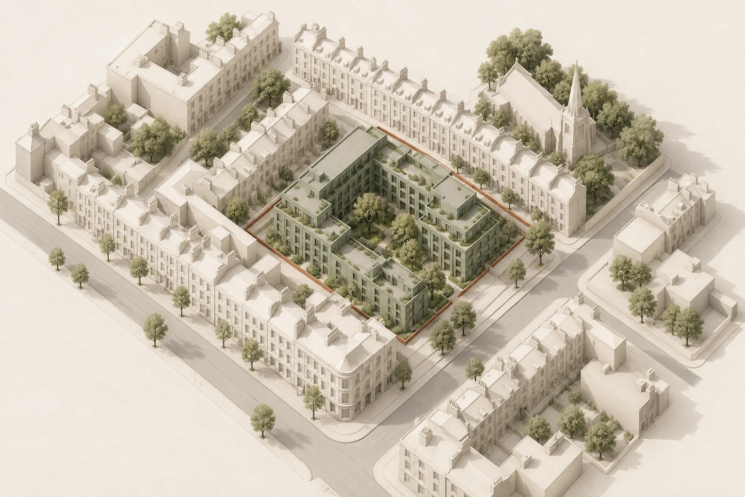
Draw or select the plot and give Atlasly a floor-area target, use, height limit and setbacks. It generates options and scores floor-area fit, height, sunlight on open space, plan depth and open space. Labels and side-by-side placement make the trade-offs easier to review.
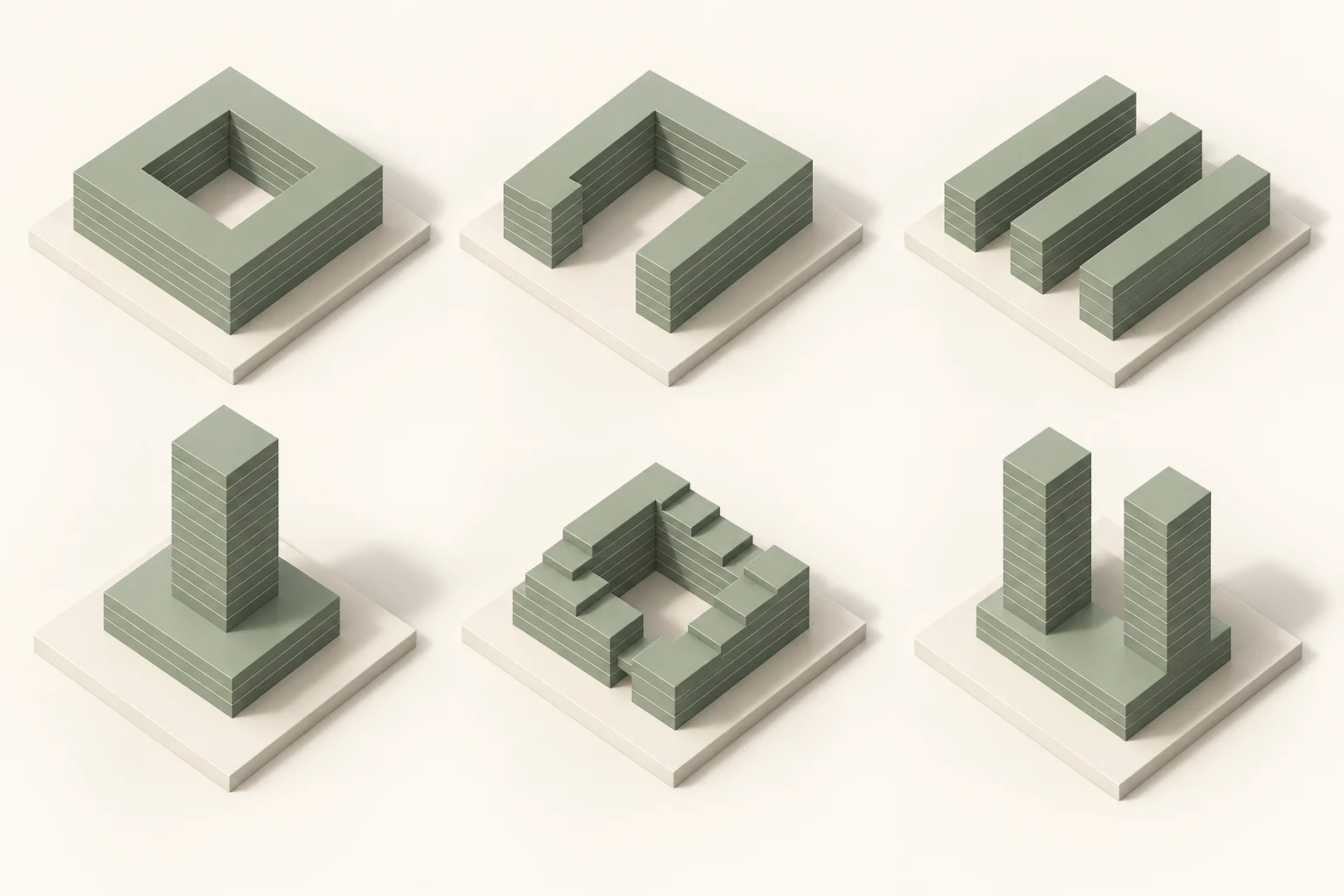
Concept illustration created for this article. These are not screenshots or measured project results.
Ten available typologies include courtyard, U, L, parallel bars, tower on podium, twin towers, point blocks, stepped courtyard, linear slab and full block.
Keep developing an option with “Slice the blocks into floors at 3.15 m floor-to-floor” or “Set back the top two floors 1.5 m from the street side.” Ask for 6, 8 and 10-storey scenarios, or an indicative home count with the efficiency assumption stated.
For an envelope check, ask “Does it fit under a 30 m height limit and a 5 m boundary setback?” Atlasly identifies the blocks and sides that fail those inputs. A geometric pass does not establish planning permission or resolve other policy constraints.
Understand the plot before committing to an option
For a drawn plot, Atlasly can report area, dimensions, road frontage by street name, the tallest neighbours with distance and direction, and ground slope. Direct-sun studies can compare 21 March, 21 June and 21 December.
That gives architects and urban designers a common basis for discussing a site: which edge addresses the street, where taller neighbours sit and how the open space behaves as the proposal changes.
Try “Analyse this plot”, then use the findings to refine your next option. For the wider due-diligence context, see our guide to 3D site context for architecture.
Check daylight and sunlight early, with the limits stated
Atlasly draws shadow shapes at chosen dates and times. It can also compare a proposal with the existing situation using Vertical Sky Component (VSC) at neighbouring windows and garden sunlight on 21 March.
The early VSC checks flag values below 27% and below 0.8 times the existing value; garden checks examine the two-hour sunlight criterion. These are screening indicators to help identify where specialist review is needed, rather than a complete assessment of every applicable criterion.
Ask “Rough VSC for the ground-floor windows opposite” or “Does the garden behind no. 14 get two hours of sun on 21 March, before and after?”
These are indicative early-stage checks using BRE 209 methods, not BRE-compliant reports. Geometry quality, window locations and the surrounding context affect the result. A daylight and sunlight consultant should assess the scheme for formal use. BRE’s daylight and sunlight guide provides the underlying practice guidance.
Turn the working model into drawings and sheets
Request a plan cut at a stated height, a section through a stair or along a line, or elevations of every facade. Cut lines remain separate and source layers are retained.
Atlasly creates A0–A4 layouts at scales including 1:1250, 1:500, 1:100 and 1:50, with a scale bar and north arrow. It can choose a scale when you have not specified one. Figure-ground plans, height labels and hatches support clearer design reviews.
Try “Ground-floor plan”, “Section through the stair”, “Four elevations” or “Make a figure-ground at 1:2500.” Review the sheet, its boundary and the relevant submission requirements before issuing it.
Exports include PDF, DWG, DXF, FBX, OBJ, SAT, STL and 3DM. Each export asks for confirmation and goes only to a folder you choose.
Clean up the file and prepare the next hand-off
A consultant DWG often needs attention before design work can begin. Ask “This DWG is a mess—what’s wrong with it?” Atlasly diagnoses wrong units, duplicates, tiny gaps, empty layers and geometry far from the origin without changing the file. Ask it to fix the issues when you are ready; it preserves the source and your tolerance setting.
For Revit or IFC preparation, it checks open polysurfaces, meshes, invalid geometry and inconsistent layer names, then fixes what it can. “Is this ready for Revit?” gives you a review of geometry readiness, rather than a promise that a complete BIM hand-off needs no further work.
Visualisers can set eye-level and aerial named views, assign materials by layer and fix flipped surfaces. Model makers can slice terrain into sheet-thickness layers, unroll and number facades, and check thin features at a chosen scale.
Computational designers can build, explain and repair Grasshopper definitions, set sliders and bake results. Everyday operations cover moving, arrays, alignment, extrusion, booleans, fillets, offsets, blocks, layers and selection by property—including individual faces and edges.
Built to keep you in control of the model
Selection gives the request its subject. “These” means the selected objects. With nothing selected, “them” refers to what the previous request made.
Rhino performs and measures the geometry. Atlasly interprets the request, uses Rhino operations and re-measures after changes. It reports failures plainly and states the basis of area figures, including GIA or GEA, wall thickness and floor-to-floor assumptions.
One request, one Undo. A request that creates hundreds of objects is grouped so you can take the whole change back together.
Consequential changes ask first. Large edits, deletion, unlocking locked objects, scripts that change objects and every export require a preview or confirmation. Ambiguous requests trigger a question: “trim the roads at the boundary” needs inside or outside clarified; “move these 2 m up” does not.
Map downloads, sun calculations and drawing generation run in the background so Rhino stays responsive.
What has actually been tested?
The September 2026 alpha report records 124 of 128 real-world architecture tasks passing end to end. Each starts with a prepared Rhino file; the request is written as a designer would ask it; the resulting geometry is measured afterwards. Tasks that should ask for clarification are checked for asking rather than guessing.
| Evidence in the internal report | What it covers |
|---|---|
| 124 / 128 tasks passed | Measured end-to-end architectural tasks; four did not pass |
| 39 UK-practice tasks | OS data, BRE checks, planning drawings and Revit preparation |
| 158 automated in-Rhino tests | Undo, geometry, exports, sunlight and daylight calculations |
| Typically 4–15 seconds per request | Observed benchmark timings; simple edits around four seconds |
| One Undo per request | Checked across every operation family |
Source: Atlasly for Rhino product brief and repository test reports, 26 September 2026, version 0.4.0-alpha.5. These are internal results, not independent certification. Request complexity, project size, network conditions and service availability can change timings.
Rhino versions, access and running costs
Early access targets Rhino 8.21 or later on macOS and Windows, with one package for both platforms. Distribution uses Rhino’s Package Manager. A Rhino 9 build is prepared for the WIP and will track McNeel’s releases; confirm compatibility with your build when invited.
It uses your own Anthropic API key, stored in macOS Keychain or Windows Credential Manager rather than files or logs. API usage is billed separately by the provider; joining the waitlist does not include usage credits or promise a final product price.
Site import uses public map data, including OpenStreetMap and Copernicus terrain. It also works with OS data your practice already holds.
Join the early-access waitlist to receive availability and setup details.
Illustrative example
A small practice starts with an address, imports the surrounding context, draws a plot and compares eight residential massing options. After reviewing heights and area assumptions, the team develops one option, checks neighbouring sunlight and prepares a scaled location plan. This is an illustrative sequence of supported tasks, not a timed customer case study.
Frequently asked
What is Atlasly for Rhino?
Atlasly for Rhino is an AI assistant for architectural work inside Rhino. It turns natural-language requests into editable geometry, site context, massing options, indicative environmental checks and scaled drawings, with results measured by Rhino.
Does Atlasly for Rhino work on Mac and Windows?
The September 2026 alpha targets Rhino 8.21 or later on macOS and Windows. A separate Rhino 9 build is prepared for the WIP; compatibility should be confirmed for your specific build when early access is offered.
Can I undo changes made by Atlasly?
Yes. Each request is grouped into one Rhino Undo, including requests that create many objects. Large or consequential changes are previewed or confirmed first, and exports always require confirmation.
Are its daylight checks BRE-compliant reports?
No. They are indicative early-stage checks using BRE 209 methods, intended to identify potential issues during design. Formal daylight and sunlight assessment requires appropriate specialist review.
Where do the site context and building heights come from?
Site import uses public map sources including OpenStreetMap and Copernicus terrain. Buildings identify whether their height came from a tagged height, storeys or an estimate. Atlasly can also work with OS data already held by a practice.
How do I get early access to Atlasly for Rhino?
Use the Rhino early-access form on this page to register your name and email. The team will contact registered applicants when access is available. Joining does not guarantee an invitation date.
Conclusion
Tell Rhino what you want. Atlasly builds it, checks it, and one Undo takes it back. Join the early-access waitlist below to try the workflow on your own architectural projects when access becomes available.
Rhino 8 · macOS & Windows
Bring Atlasly into your Rhino workflow.
Join the Atlasly for Rhino early-access waitlist. We’ll email you when access is available, with details on getting started.
To withdraw your request, email [email protected]. No invitation date is guaranteed. Rhino and your own Anthropic API key are required; API usage is billed separately.
Rhino is a registered trademark of Robert McNeel & Associates. Atlasly for Rhino is developed by Atlasly.
About the author
Shatakshi Patil
Architect writing about pre-construction due diligence, planning context, and site intelligence workflows for design teams using Atlasly.
Sources and references
Authoritative references for the planning policies, regulations, and standards referenced in this article. Always check the publisher for the latest version.
Related articles
Auto-suggested
3D site context for architects
3D Site Context for Architects: Data, Exports and Review Checklist
Build useful 3D site context from terrain and surrounding buildings. Check height assumptions, units, coordinates and export quality before design handover.
Read
Workflow
How to Export Site Context to DXF for AutoCAD Using Atlasly
Export available Atlasly site context to DXF and check layers, units, coordinates and geometry before using it in AutoCAD or another supported CAD workflow.
Read
Technical
Daylight and Sunlight Analysis (BRE 209): What Architects Actually Need to Know
How to scope a daylight and sunlight assessment using BRE BR 209 (2022), distinguish advisory targets from planning decisions, and retain the evidence behind design comparisons.
Read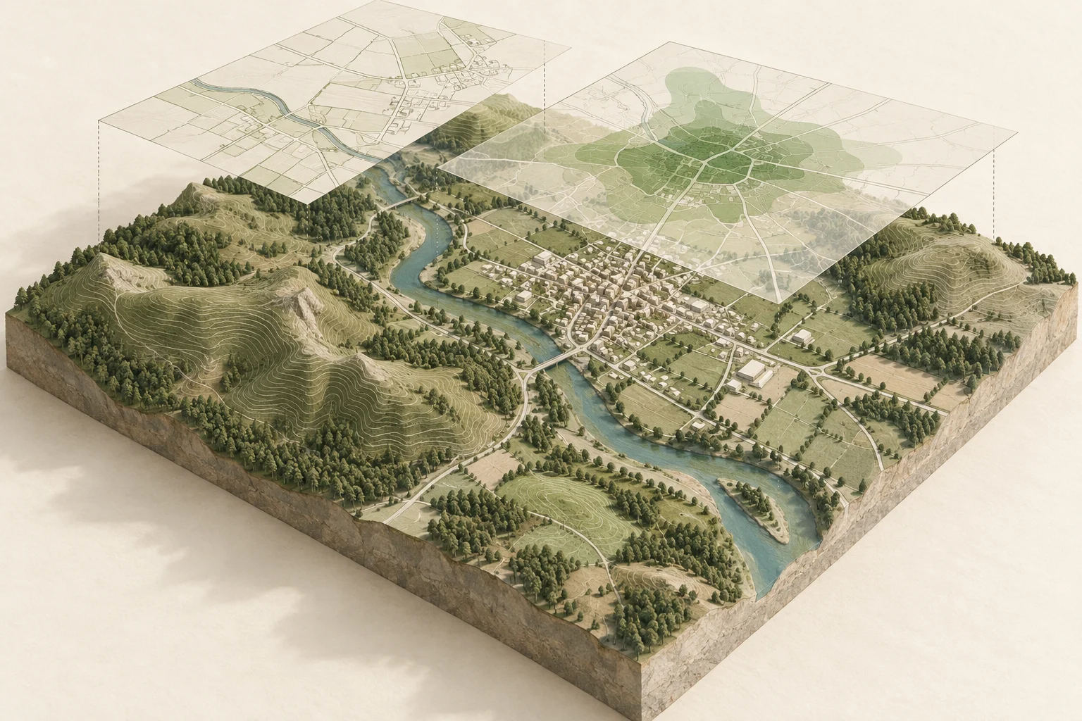
Product news
Atlasly for QGIS: the AI GIS analyst that checks its own work
Ask the question. Get the analysis, the map and the method. Meet Atlasly: an AI assistant inside QGIS that takes geospatial work from first layer to finished deliverable.
Read